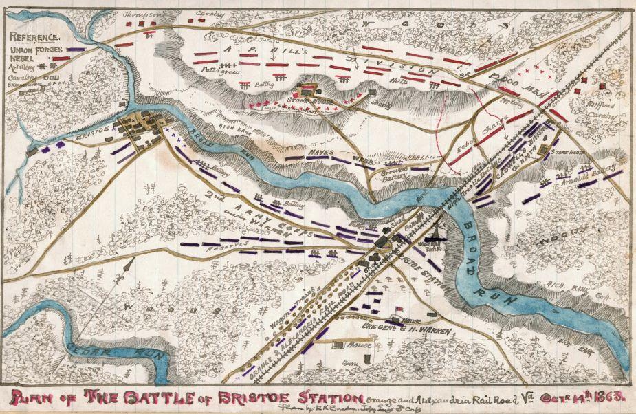
Plan of the Battle of Bristoe Station
Historical map of the Battle of Bristoe Station
Plan of the Battle of Bristoe Station, Virginia on October 14, 1863
Sneden, Robert Knox, 1832-1918.
[1863-1865]
Shows the area of Fairfax County, Va., which was the site of the Battle of Bristoe Station. The map is oriented with Cedar Run to the south, Bristoe to the west and indicates the route of the Orange and Alexandria Railroad. Also indicated are A. P. Hill's Corps, Army of Northern Virginia, engaging the Union's II Corps during its withdrawal toward Centreville, Va.
Color coding indicates the location of Union and Confederate forces.
Relief shown by hachures.
"Fought on Genl Meade's flank march on Centreville, Va." - page caption.
This item is from the collections of the Virginia Historical Society; please contact the institution for more information.
Robert Knox Sneden Diary (Mss5:1 Sn237:1), Virginia Historical Society, Richmond, Va.
In the Robert Knox Sneden Scrapbook (Mss5:7 Sn237:1 p. 197).
Manuscripts
Virginia Historical Society, P.O. Box 7311, Richmond, VA 23221-0311 USA
Learn More: The Battle of Bristoe Station
Related Battles
540
1,380