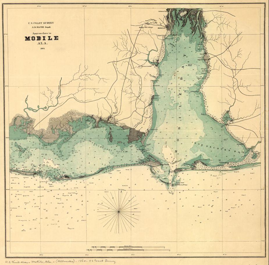
Approaches to Mobile, Ala. 1864.
Historic map of Mobile, Alabama
United States Coast Survey, 1864
Created/Published
[S.l., 1864]
Scale ca. 1:205,000.
Reference: LC Civil War Maps (2nd ed.), 109
Map of Mobile Bay showing forts, towns, soundings, and a few roads.
Description derived from published bibliography.
Library of Congress Geography and Map Division Washington, D.C. 20540-4650
_______
A combined Union force initiated operations to close Mobile Bay to blockade running. On August 5, Rear Admiral David Farragut’s Union fleet of eighteen ships boldly entered Mobile Bay and received a devastating fire from Forts Gaines and Morgan and other points. After passing the forts, Farragut engaged in a slow-motion slugfest with the Confederate ironclad CSS Tennessee, under the command of Adm. Franklin Buchanan. After forcing the Tennessee to surrender, Union forces besieged Fort Gaines and Fort Morgan, which controlled the mouth of Mobile Bay. By August 23, Fort Morgan, the last big holdout, fell, shutting down the strategic port. The city, however, remained uncaptured.
Learn More: The Battle of Mobile Bay
Related Battles
322
1,500