“In Letters of Iron”

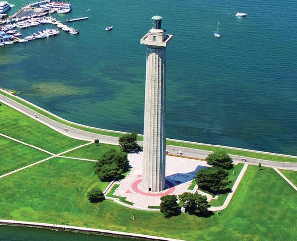
In a quiet ravine on the eastern side of the Shiloh Battlefield stands a solitary red iron marker. It is easily missed by all but the most resolute tourists who walk the trail down into the ravine, yet going to this specific site is important. It was here that Confederate general Albert Sidney Johnston, commander of the Army of the Mississippi, breathed his last. He had been shot in the leg a few minutes earlier while leading a charge up on the higher ground to the north, but he soon lost consciousness as his blood began to run out. Staff officers took him into this ravine to get him out of further danger, but he died around 2:30 p.m., April 6, 1862. Johnston was the highest-ranking Confederate to die in the Civil War, and is the highest-ranking American military officer to die in combat in all of American history. It is an important marker that stands in that ravine, denoting an extremely significant site.[1]

The iron (and sometimes bronze) tablets that dot the various Civil War battlefields, including Johnston’s death site, serve that specific purpose: to mark significant and historic sites and to do so without subjection or partisanship. The officials overseeing construction of the battlefield park at Shiloh noted that they would “mark, in letters of iron, the history of the battle.” These tablets and markers, funded by the United States congress, placed by United States government commissions appointed by the United States secretary of war, and standing on United States Department of the Interior parkland (the battlefields were military reservations under the War Department originally), serve a distinct role in telling the story of events at each battlefield without the memorialization baggage of monuments that were placed instead by the various states. In the Johnston tablet case, the Shiloh Battlefield commission placed the marker using federal government funds on a military-owned battlefield to mark an extremely significant historic site that, incidentally, had been located by a United States senator who was a veteran of the battle. It was not a Johnston shrine or memorial, but rather a matter-of-fact documentation by participants who would not be around much longer; if not for the iron markers being placed, such eyewitness perspectives might be taken with them to their graves.[2]
The various monuments on the battlefields are slightly different in that they were not federal government funded or erected, although the congressional enabling legislation for each battlefield specifically allowed their placement. Rather, the monuments on America’s Civil War battlefields were largely placed by the individual states to recognize and honor their own units. It is fitting that this occurred, as most of the individual volunteer regiments that fought in the Civil War carried state designations rather than United States or Confederate government denotations. As such, there are more aspects of memorial and honor features in the monuments that dot the battlefields, but even still their additional historic purpose of marking specific sites cannot be ignored. Many states took distinct care to use veteran testimony to mark the place of the regiment’s most significant fighting at each battlefield. As a result, even these more memorial-slanted monuments still carry with them an important duty of marking for posterity the sites of significant events that if never marked, or removed, would lead to a massive loss of historical knowledge.[3]
Although marking the battlefields began during the war itself — one wartime visitor to Chickamauga described “little wooden tablets driven into the ground and . . . shingles nailed to the trees, indicating positions of commands during the battle” — the vast majority of the battlefield tablets in America rest on the “Golden Age” parks that were created in the 1890s. Civil War veterans of both North and South, who at one point in the early 1890s made up more than half of Congress, wanted to leave future Americans their historic knowledge on the actual battlefields where they had fought 30 years earlier. There was a definite feeling of time running out and they wanted to leave to posterity their history. As such, Congress created military parks at Chickamauga-Chattanooga, Antietam, Shiloh, Gettysburg and Vicksburg, and included language in the enabling legislation of each that tablets would mark the lines of battle: “tablets, monuments, or such other artificial works as may from time to time be erected by proper authority.”[4]
Originally under the War Department, these parks had governing commissions of veterans who actually did this work, appointed by the secretary of war and paid with federal funds. The battlefield commissions, to write the history of each battle on the field itself, primarily chose to use tablets to mark troop positions and obsolete cannon barrels on reproduction carriages to mark artillery locations. States of course also marked their regiments’ most significant actions at each field with larger monuments which served the same purpose. There was an added significance as well: modern military officers at the time, as they still do today, studied these great campaigns and battles to learn the lessons of history. One congressman assured his colleagues that a marked battlefield “would be worth an entire course in textbooks on the strategy of a campaign and battle tactics.” Others agreed. “These tablets are of iron . . .” one newspaper reported of the work at Chickamauga, “[and] are so complete and accurate that a perfect stranger, by their aid, will have no trouble in locating the various positions of any body of troops engaged in that great battle.”[5]
These tablets and artillery positions, as well as the monuments themselves, although they also have certain memorial qualities attached, tell the story of each battle in nonpartisan fashion, simply locating significant events. The Gettysburg commission assured that “much thought has been given to the preparation of these tablets and their inscriptions for the Confederate commands, so as to arrive at the utmost possible historic accuracy with regard to each one as well as perfect consistency and fairness among them as a whole. This is a work requiring great deliberation and painstaking [work], but we hope to accomplish it satisfactorily.”
Yet each battlefield commission went about creating the thousands of tablets in different ways; for instance, the Gettysburg and Antietam officials simply marked each sides’ positions with the same type of tablet, bronze at Gettysburg and simple iron originally painted black and white at Antietam. Conversely, the Shiloh, Chickamauga and Vicksburg commissions chose to color code their tablets, with red indicating a Confederate unit position and blue denoting a Union unit’s location; in the case of Shiloh, there was a third army involved, and it gained yellow tablets. Shiloh, in fact, was the most progressive of the commissions and also differentiated the days of battle by different shaped tablets, square for day one and oval for day two; none of the other commissions went so far in its tablature. As these tablets stood, if possible, at the precise location of the regiments or brigades and faced the direction the unit faced, visitors could immediately tell where the unit in question was, which way it faced, whose side the tablet denoted, and in Shiloh’s case which day of battle it was there. If approached closer, the text on each tablet gave greater detail concerning the action there. The combined effect was a massive amount of historic knowledge set literally on the site where it took place.[6]

Although the first five battlefields of the 1890s took most of the limelight then and now, other battlefields also received federal government tablets to mark specific locations even if they did not garner the coveted status of a national park at the time. War Department planners in the 1890s and early 1900s were very cognizant of the history being lost with the passing of each veteran, which was increasing in frequency around the turn of the century. They accordingly sent their main battlefield preservationist, Col. George B. Davis, to mark other battlefields. Davis had been involved in his dual role of battlefield preservation as well as his normal army jobs, such as professor at West Point, line duty out west, as well as finishing his career as a brigadier general and the army’s judge advocate general. In his career, Davis had also worked on the publication of the Official Records as well as serving on the board that created the Antietam park. Secretary of War Elihu Root sent Davis in the early 1900s to survey and mark other battlefields as well even if they were not parks; there were still significant sites on those privately owned battlefields that needed to be marked before the veterans who could locate them vanished.[7]
Much of Davis’ work centered on Virginia battlefields such as Manassas and Appomattox. Davis, for instance, marked significant sites at these battlefields long before they were ever included in the national park system decades later. At Appomattox, for example, Davis marked headquarters sites, the final meeting place between Robert E. Lee and Ulysses S. Grant, and some of the fighting area around the village such as where the last cannon shot had occurred. Had Davis not marked these sites at the time, they may never have been marked and thus lost to history. Davis, a Union veteran of the Civil War and then an officer in the United States military, marked both sides equally without partisanship or any memorial qualities.[8]
As the decades moved on and the Civil War veterans began to die out, other efforts to mark the battlefields fortunately came along, particularly in the 1920s and 1930s. Congress tasked the Army War College to rate the battlefields and recommend markings, which it did, most being defined as “battles of such great military and historic interest as to warrant locating and indicating the battle lines of the forces engaged by a series of markers or tablets, but not necessarily by memorial monuments.” Additional parks such as those at Stones River, Fort Donelson, Kennesaw Mountain, Petersburg, Richmond, and around Fredericksburg and Manassas fortunately came into being while there were still a few old Civil War veterans around to mark specific sites. While these battlefields had similar federal government sponsored, funded, and erected tablets placed on them, they were sadly not as well marked even as the battlefields themselves were not as well preserved due to the effects of urbanization. Still, these tablets marked significant sites that could be located by the few veterans still around that long after the Civil War. Later-established battlefield parks such as Wilson Creek or Pea Ridge gained tablets too, but were more endowed by the newer generation of the same idea, the National Park Service wayside exhibit. But the intent was the exact same, to provide visitors and those studying the battles the historic information about what occurred on these spots. While much more numerous on the earlier parks because the veterans themselves could locate so many more specific positions than modern historians can, the tablets served the same exact purpose as the modern wayside interpretive panels found on national parks today, with the same evenness and nonpartisanship.[9]
The historic importance of the tablets on Civil War battlefields is beyond question. The veterans themselves, North and South, documented where specific events took place, and the federal government marked these sites with federally funded, federally erected, and federally maintained tablets that collectively give modern historians and military officers, as well as tourists, an amazing resource that if removed would delete an extremely prodigious amount of knowledge about these battles and our great Civil War. In fact, the veterans desired that the battlefields be restored and maintained in the fashion they were in at the time of the battle, and to denote the thousands of troops on the field at the time they resorted to monuments and primarily tablets, which some consider gaudy intrusions to the beautiful landscapes but clearly were intended to be part of the original fabric of the contemporary battlefields of the Civil War. The oldest of these tablets, themselves now well over a hundred years old, are historic in their own right, and removal would delete an entire layer of history that can never be replaced.[10]

Without partisanship or memorial features at all, these tablets simply denote some of the most significant and important sites in all of American history and provide context for what occurred on these fields. Before these impartial markers had been erected to delineate both sides, the chief pusher of the Gettysburg park idea, John Bachelder, significantly asked, “was there no opposing army at Gettysburg, where was the enemy?” It would be a disgrace to return to those partisan, prejudiced, and divisive days again.[11]
[1] For Johnston, see Charles P. Roland, Albert Sidney Johnston: Soldier of Three Republics (Austin: University of Texas Press, 1964).
[2] Cornelius Cadle to Secretary of War, February 23, 1901, Shiloh National Military Park Commission Daily Events, February 20, 1901, Shiloh National Military Park, 23; Cornelius Cadle to Robert F. Looney, August 10, 1895, Robert F. Looney Collection, Memphis Shelby County Public Library.
[3] For state monuments, see Timothy B. Smith, This Great Battlefield of Shiloh: History, Memory, and the Establishment of a Civil War National Military Park (Knoxville: University of Tennessee Press, 2004), 137-138.
[4] James B. Shaw, History of the Tenth Indiana Volunteer Infantry (Lafayette: Burt-Hayward Co., 1912), 274-275; Timothy B. Smith, Altogether Fitting and Proper: Civil War Battlefield Preservation in History, Memory, and Policy, 1861-2015 (Knoxville: University of Tennessee Press, 2017), 36; Congressional Record, 51st Congress, 1st Session, 21, 6: 5393.
[5] Timothy B. Smith, A Chickamauga Memorial: The Establishment of America’s First Civil War National Military Park (Knoxville: University of Tennessee Press, 2009), Ronald F. Lee, The Origin and Evolution of the National Military Park Idea (Washington DC: National Park Service, 1973), 35-36.
[6] Gettysburg National Military Park Commission, Annual Reports to the Secretary of War, 1893-1901 (Washington DC: Government Printing Office, 1902), 22, 33-34; Timothy B. Smith, The Golden Age of Battlefield Preservation: The Decade of the 1890s and the Establishment of America’s First Five Military Parks (Knoxville: University of Tennessee Press, 2008), 108, 132, 162, 177-178, 200, 215-216; Smith, A Chickamauga Memorial, 45, 68, 100; Smith, This Great Battlefield of Shiloh, 71.
[7] Smith, Altogether Fitting and Proper, 40.
[8] Smith, Altogether Fitting and Proper, 49.
[9] House Reports, No. 1071, 69th Congress, 1st Session, 4-8; Smith, Altogether Fitting and Proper, 85-86, 139.
[10] Smith, The Golden Age of Battlefield Preservation, 8.
[11] Harlan D. Unrau, Administrative History: Gettysburg National Military Park and National Cemetery (Washington DC: National Park Service, 1991), 62; Mary Munsell Abroe, “’All the Profound Scenes:’ Federal Preservation of Civil War Battlefields, 1861-1990” (Ph.D. dissertation, Loyola Univ. Chicago, 1996), 151.