The Hidden Marker for the 7th Georgia Infantry
By Gregory Wolf, Park Historian at Manassas National Battlefield; Hallowed Ground Magazine, Spring 2011
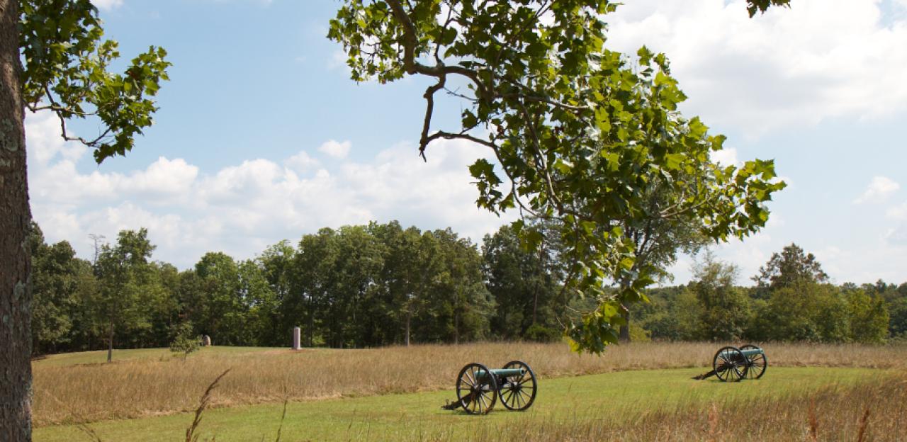
Less than a hundred yards to the north of the Manassas National Battlefield Park visitor center, amidst the 10-pounder Parrott rifles and limbers marking the position of Capt. James B. Ricketts’s Union artillery on the mid-afternoon of July 21, 1861, a small stone marker momentarily captures the interest of many park visitors as they explore the somber landscape and well-manicured trails atop Henry Hill. Barely as large as a laptop computer or a school textbook, the front face of the 10-inch-wide and 18-inchtall piece of white limestone proclaims:
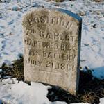
POSITION
7th GA. REGT.
Captured Ricketts
Battery
July 21, 1861
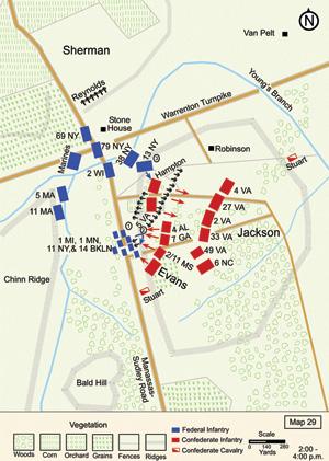
A small interpretive wayside in front of the stone introduces as many questions as it answers. “Sometime after 1903 veterans of the 7th Georgia Infantry erected at least six markers on the Manassas battlefield to locate battle positions,” it reads. “Only this marker and one other approximately 350 yards southeast of here survive. Colonel Francis S. Bartow was killed while leading the 7th Georgia against Captain James B. Ricketts’ battery. During the battle, the 7th Georgia suffered 153 casualties out of 580 men present.” When, specifically, were the stones erected? Why did these veterans choose to mark multiple locations with small stones rather than pool their resources and erect a single large marker at one significant location? What happened to the other stones? How can I find the other surviving stone?
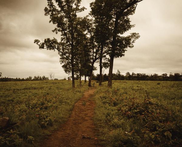
While the first stone marker, despite its small stature, is observed by tens of thousands of park visitors every year, its last surviving fellow, though only 350 yards away, is found by a statistically negligible percentage of battlefield stompers. Located amidst seldom-mowed grass at the base of a quartet of oak and red cedar trees near a horse trail through a grassy field on the eastern slope of the Henry Hill plateau, those wishing to find the “5TH POSITION” stone require a keen eye, detailed directions and good luck.
For those employing GPS devices or satellite imagery to orient themselves on the battlefield, the “other” 7th Georgia marker is found at N 38.816205 W -77.516873. For traditionalists, or GPS users not looking to bushwhack through the woods and fields to find these coordinates, directions given here should assist with your search.
Unfortunately, the other stone markers are no longer found at their original locations on the battlefield. Twentieth-century farming operations, road widening projects, relic hunting, irreverent vandalism and neglect have led to their loss or removal from this commemorative landscape. Clearly, the small dimensions of these markers have made them especially vulnerable to these threats. We hope you will help the park in its mission to preserve this cultural resource and that you enjoy this trek “off the beaten path …”
Finding the Georgia Marker
From the Henry Hill parking lot walk eastbound on the First Manassas Trail; less than a hundred yards after passing through “Stonewall” Jackson’s artillery line and a thin curtain of cedar trees, the trail appears to present you with a fork in the road. The prescribed trail utilizes the right fork; the left fork is merely a maintenance vehicle roadway. Take this left fork and follow its route as it makes a sweeping left turn toward a small grassy field to the north.
Less than 100 yards after completing the curve, the roadway passes a 90 degree left turn, unmarked and barely discernable in winter. Take the left turn and walk west across the field. Continuing westward, the trail crosses a short open space
As the trail gradually turns north along the treeline, you will see a grouping of oak and cedar trees in some brush to your right-front, somewhat isolated from the rest of the woods. In 2011 this was a quartet of trees, now a trio, and soon to be a duo as one of the remaining trees appears dead. The trail forms a divide between the woods and this tree/brush grouping. The “other” 7th Georgia stone marker is found less than an arm’s length away from the north side of one of the tree trunks.

Related Battles
2,896
1,982