Vicinity of Brandy Station
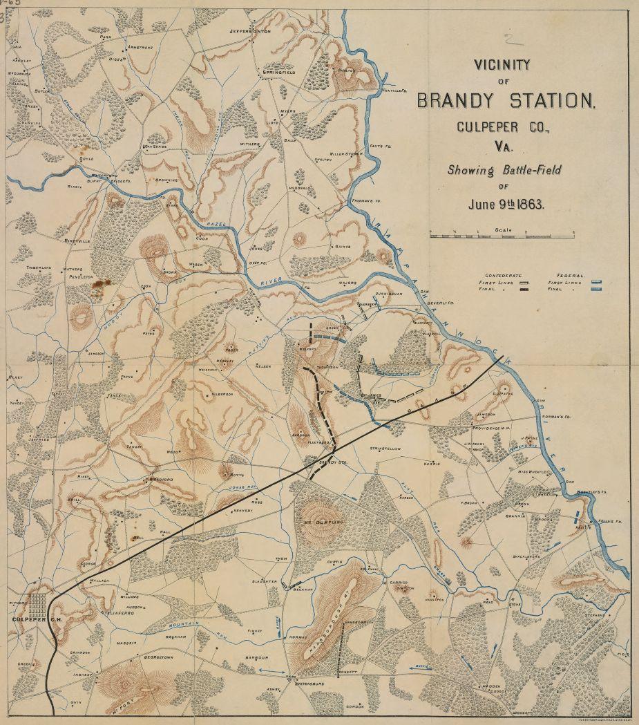
Historical Map of the Battle of Brandy Station
Vicinity of Brandy Station, Culpeper County, Virginia showing battlefield of June 9th 1863
Cincinnati : Strobridge Lith. Co., [1863?]
Relief shown by hachures.
Shows location of troop lines.
This item is in the Map Collection of the Library of Virginia
c.1, map accession no. 5190x; c.2 (negative photostat, on sheet 32 x 29 cm.); c.3 (positive photostat, on sheet 33 x 29 cm.).
Civil War Map Proj. no.: LVA00059.
Conservation: Etherington Conservation Center, May 2002.
Digital image available: 16.5 x 14.5 in.
Previously filed as: 755.383 M6 1861-1865 1863.
Scale 1 mile = 1 in.
Library of Virginia Richmond, VA 23219-8000 USA
Learn More: Battle of Brandy Station
This will be the only chance we will ever have to protect these 97 acres at Brandy Station, and the other 7 acres near Cedar Mountain, and we urgently...
Related Battles
866
433