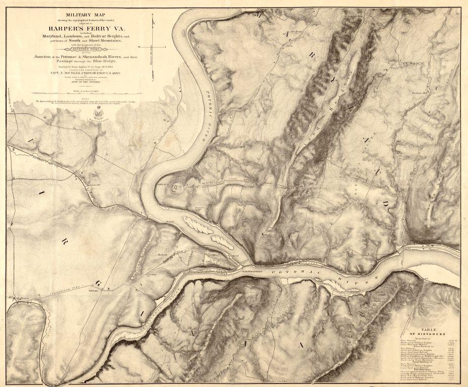
Military map of Harpers Ferry, Virginia
Historical map of Harpers Ferry
Topographical features of Harpers Ferry and the adjecent country
Military map showing the topographical features of the country adjacent to Harpers Ferry, Va.; including Maryland, Loudoun, and Bolivar Heights, and portions of South and Short Mountains, with the positions of the defensive works, also the junction of the Potomac & Shenandoah Rivers, and their passage through the Blue Ridge. Surveyed from August 3d to Sept. 20th 1863, under the direction of Capt. N. Michler, Corps of Engrs., U.S. Army, by Major John E. Weyss, Principal Assistant, Engineer Department, Army of the Potomac. Lettering by Wm. Hesselbach. Engraved in the Engr. Dept.
Weyss, J. E.
[S.l., 1863]
Scale 1:15,840.
Reference: LC Civil War Maps (2nd ed.), 700
Printed edition of the preceding map indicating relief by hachures rather than by contour lines.
Description derived from published bibliography.
Library of Congress Geography and Map Division Washington, D.C. 20540-4650
Learn More: Harpers Ferry
Related Battles
12,636
286