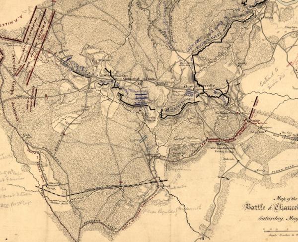
Map of the Battlefield at Chancellorsville
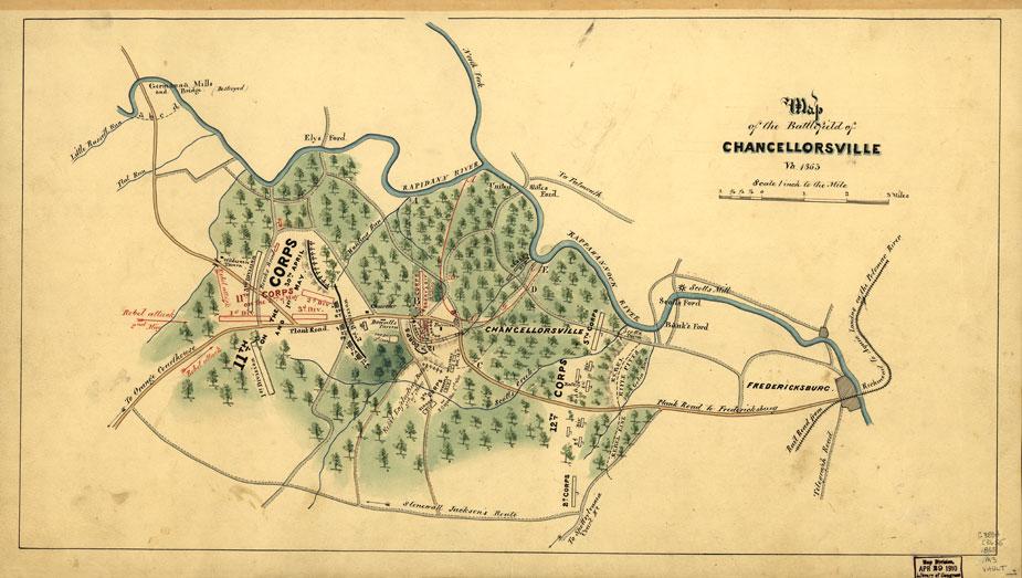
Map of the battlefield at Chancellorsville
Library of Congress
Historical map of the Battle of Chancellorsville
Map of the battlefield of Chancellorsville, Virginia, 1863
[S.l.], 1863.
Scale 1:63,360.
Reference: LC Civil War Maps (2nd ed.), 528
Shows troop positions and movements, roads, railroad, drainage, fords, and vegetation.
Description derived from published bibliography.
Library of Congress Geography and Map Division Washington, D.C. 20540-465
CalltoArms
Help Restore Six Sacred Battlefield Sites
The Opportunity At Gettysburg, at Chancellorsville, at Seven Pines, and two other hallowed battlefields of the Civil War, vacant buildings now stand...
Related Battles
Battle Facts
Spotsylvania County, VA | April 30, 1863
Result: Confederate Victory
Estimated Casualties
30,764
Union
17,304
17,304
Confed.
13,460
13,460