Historical Map of the Battle of Perryville
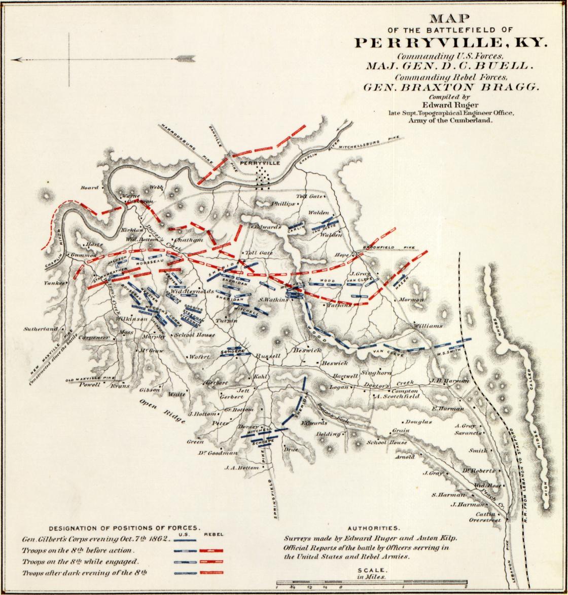
Historical Map of the Battle of Perryville
History of the Army of the Cumberland : its organization, campaigns, and battles, written at the request of Major-General George H. Thomas chiefly from his private military journal and official and other documents furnished by him / by Thomas B. Van Horne ; illustrated with campaign and battle maps, compiled by Edward Ruger.
Van Horne, Thomas B. d. 1895. (Thomas Budd),
Other Titles
Army of the Cumberland--atlas
Created/Published
Cincinnati : R. Clarke & Co., 1875.
Notes
Relief shown by shading and hachures on some maps. Depths shown by contours on some maps..
The format of this atlas as issued was 3 p. l., 22 col. fold. maps, 23 x 15 cm. The letter press and maps have been mounted and rebound as above.
Atlas accompanies two-volume history by Thomas B. Van Horne.
Reference: LC Civil War maps (2nd ed.), 102
For table of contents see P.L. Phillip's A List of Geographical Atlases in the Library of Congress (Washington, Government Printing Office, 1920) v. 4, no. 4519.
The Geography and Map Division also has separates for plates 2-5, 7-10, 17-19, and 21.
Title and introductory pages affixed on prelim. leaves of atlas.
Includes maps of the battles of Selma, Alabama; Bentonville, North Carolina; Chattanooga, Franklin, Nashville and Stones River, Tennessee; Chickamauga and Atlanta, Georgia; and Perryville, Kentucky.
Description derived from published bibliography.
Scales differ.
Learn More: The Battle of Perryville
Related Battles
4,211
3,401