Their story has been well told by historians throughout the years. Lee’s army, desperate to reach needed supplies, passes through the village of Appomattox Court House then trudges along another three miles in their attempt to reach Appomattox Station on the South Side Rail Road. There, three trainloads of quartermaster stores and other sundry items, sent from Lynchburg, await them. Pursued by two Union army corps in their rear, the Second and the Sixth, they are not aware that Federal cavalry with two more corps are moving quickly toward the station along another route. It will be a race that eventually brings about the demise of the Army of Northern Virginia.
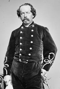
The head of Lee’s column was led by General R. Lindsey Walker, his Third Corps artillery commander, who had with him the army’s surplus artillery (about 25 to 50 guns), baggage and hospital trains, and numerous artillerymen armed as infantry. Passing through the courthouse village at about 10 a.m. on the morning of April 8, 1865, Walker then had his men go into park about a mile from the station. Guarding the area between them and the trains were Confederate engineers under Colonel T.M.R. Talcott and a small cavalry brigade led by South Carolina General Martin W. Gary. Never expecting northern troops to be approaching the scene, no one was prepared for what was about to happen.
General Philip H. Sheridan’s cavalry, along with General Edward O.C. Ord’s Army of the James (the Twenty-Fourth Corps along with portions of the Twenty-Fifth), and followed by General Charles Griffin’s Fifth Corps, were taking a shorter and more southerly route to the station than Lee was following from his earlier point of departure north of Farmville. They only had to cover approximately a 30 mile span while Lee’s men had to march about 38 miles to reach the same destination on the 8th. This development was allowing Grant’s army to complete its pincer movement by cutting off the Confederate army’s line of march toward the west. The curtain was quickly coming to a close in the rolling hills around Appomattox.
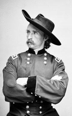
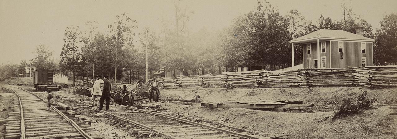
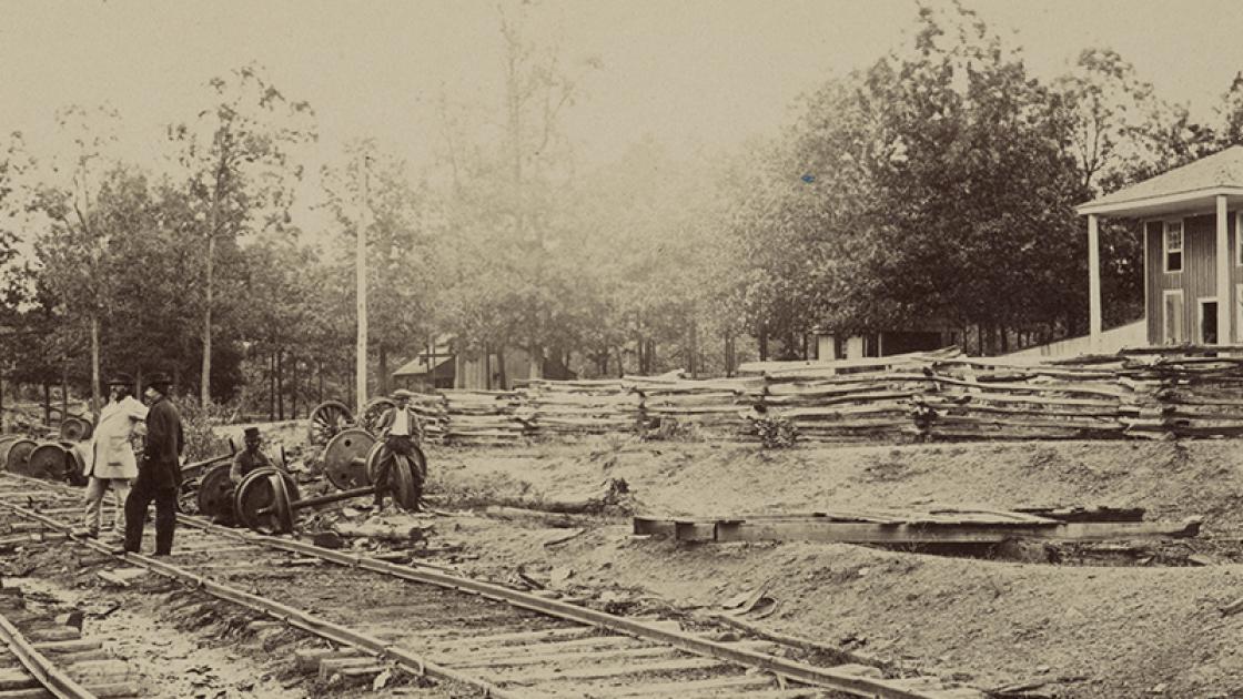
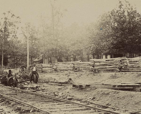
Advance squadrons of General George A. Custer’s troopers soon reached Appomattox Station after hearing earlier about the trains waiting there. It took but a single regiment, the 2nd New York Cavalry, to capture them without a fight while two other regiments rode around behind the trains and tore up a few rails preventing them from escaping to Lynchburg.
Back in Walker’s camp, the men looked in the direction of the station only to see Custer’s horsemen begin forming for an attack. “Yankees! Sheridan!” “The cavalry are coming, they are at the station and coming up the hill!” Commands were barked out as the men prepared themselves for an impending cavalry charge against them. It was now about 4 p.m. as Walker placed Gary’s dismounted cavalry on his flanks while setting up his cannons in a hollow circle along a slight ridge facing the station area. Those cannoneers armed with muskets were sent forward from the artillery to act as skirmishers. What was soon to become the battlefield was not really suitable for cavalry or artillery fighting but the choice was not theirs to decide. It was densely overgrown with timber and brush, being only intersected by small dirt bridle paths cutting through it here and there.
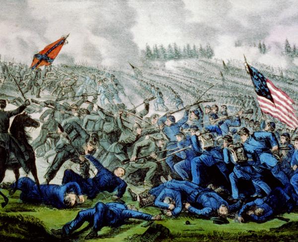
Custer’s first brigade, led by Colonel Alexander C.M. Pennington, came upon the scene and attempted to make a haphazard and uncoordinated attack upon the Confederate artillery battle line. Using canister at close range against the mounted Union troopers, Walker’s men threw back this initial probe. Colonel Henry Capehart’s “West Virginia” or third brigade soon arrived and they too were unsuccessful in charging the Southern cannoneers. Finally, between 8 and 9 p.m., under the cover of darkness but using light attributed to a full moon, Custer threw in his newly arrived second brigade of Colonel William Wells. In what was to become the final push, all three brigades began their ride into a hail of canister with their commanding general leading through the wooded trails until they reached the enemy guns. At this point the artillery defenders either scattered or were captured by Custer’s men as the fighting came to a close.
That evening as the battlefield was scoured for wounded and more prisoners, Custer’s Third Division would bring in between 24 to 30 cannon, around 150 to 200 wagons, and close to 1,000 prisoners. In one of the wagons was found Confederate General Young Moody who was sick and riding in it. The approximate casualties for the Federals were 5 killed, 40 wounded, and 3 missing. Confederate losses are unknown.
The story of the engagements at Appomattox Station and the one the next morning at Appomattox Court House, has been pretty much overshadowed by the surrender the afternoon of the 9th. Few realize that it was these two clashes which were directly accountable for Lee surrendering when and where he did. With Grant’s army being able get across his avenue of escape, the Southern commander’s alternatives were diminished greatly. With General George G. Meade’s two corps in the rear, and the Fifth Corps and Sheridan’s cavalry coming in on his flank, the Army of the James in front, the double envelopment was now complete.
It would be another century before any attempts were made to locate the site of the battle of Appomattox Station. With merely vague descriptions that placed the fight “a mile from the station,” one could only guess that the battlefield had become engulfed by the boundaries of the present-day town of Appomattox that surrounds the old station site. In fact, the most plausible location of the engagement seemed to be a triangular tract of land formed by the junction of routes 460, 24 and 26. In the early 1970’s that site was developed into Triangle Shopping Center and it too fell to asphalt and a strip mall. It wouldn’t be until the mid-70’s, quite by accident, that it was found. A large portion of the Appomattox Station battlefield did indeed still remain tucked away just outside the town limits.
I had been trying to locate and document the site of camps and the battlefields around Appomattox area for a couple of years when I stumbled on the April 8th action. Led to the area by a sentence in the Official Record report (Vol. 46, Part I, p.1129) of Brig. Genl. Alfred Gibbs of the Federal cavalry: “The brigade camped for the night [of April 9] at a wood near Martin’s house, one mile in rear of Appomattox Court House.”
Looking at the 1867 U.S. army surveyed Micheler map of “Appomattox Court House and Vicinity” I quickly found two house sites listed as B. Martin and W.C. Martin next to each other between the county seat village and the station. Presumably it was near one of these that General Gibbs was referring to. Getting out a USGS topographical map of that area and overlaying the Martin house sites, I found that their location still remained tucked away behind a school and a local trucking company. The area was relatively wooded and overgrown with briers, being cut by a wet-weather branch of a small creek, Plain Run, along with a few old road traces that were still discernable. The site’s location and topography kept it pretty much from being developed (although the Route 460 By-Pass would later cut through the area), leaving this island of undeveloped land untouched.
Armed with permission from the landowner and a metal detector, I parked in the truck lot and headed down into the woods. Expecting to find artifacts denoting a Union cavalry campsite, oddly the numerous signals I soon found generally turned out to be iron canister rounds. After a few return visits, the numbers of these began to grow until I had over a couple hundred of the balls, most ranging 1” in diameter. They were not just located in one central area but rather scattered throughout the woods as if they had been fired from cannon (On four early visits to the area commencing on December 3, 1976, I found the following quantities of canister balls each time: 76; 39; 37; and 45).
As I would return to my vehicle after each visit to the site, I began finding a quantity of friction primers along the top of a ridge skirting the parking lot. Some were fired, and some were not still having the lanyard wires attached to them. These primers were used to ignite the powder charge that fired the cannon and are the physical evidence left of the position of artillery pieces.
While I continued my search for the cavalry camp, the only other items I found were some mainly fired U.S and C.S. cavalry and rifle projectiles, a few shell fragments, and a handmade lead “eagle” button along with a Confederate tin-back “I” and “A” button. On the bank of one of the old road beds which ran through the property I found a ground burst Federal Schenkl artillery shell with its fuse and case shot still in the hole…only two small pieces were missing when I reconstructed it. Not finding the evasive camp, and having my share of canister balls, I soon put the site aside for a while.
A few years later, after obtaining a research grant through the United States Army Military History Institute, I began assembling all my research for a book on the battles of Appomattox. Using a multitude of primary sources I had collected over the years, along with my field notes from “ground truthing” these sites (which were, at that time, all on private property), I set out to reconstruct the troop movements of both armies in those final two days of the war in Virginia. The findings would later be published in the “Virginia Civil War Battles and Leaders Series” volume known as The Battles of Appomattox Station and Appomattox Court House, April 8-9, 1865 (H.E. Howard, Inc. 1987). It was during this time that I came across a document that proved to be the “Rosetta Stone” of the Appomattox Station battle story.
The Cincinnati Historical Society in Ohio proved to be the home of a fabulous manuscript written by a Union cavalryman named Roger Hannaford, Company M, 2nd Ohio Cavalry. A portion of Hannaford’s diary/manuscript had been published in The Virginia Magazine (Vol. 87, No. 4, Oct. 1979) entitled “Dinwiddie Court House and Five Forks,” edited by Stephen Z. Starr. Upon reading it, I was amazed at Hannaford’s eye for detail as I was extremely familiar with both these battlefields, now being the historian for Petersburg National Battlefield. I wondered what trooper Hannaford had to say about the rest of the campaign to Appomattox.
I contacted the historical society and requested copies of everything in Hannaford’s manuscript from April 3 through April 12. Little did I realize what I was about to receive in the mail when it finally arrived. Not only did this cavalryman describe in specifics his role in the final campaign, but drew little annotated maps of each engagement he was in, keying his narrative to them with letters. Written in long hand, I began transcribing his entries for April 8 and 9 since I would need that information first for my study. At first glance, one might not see any rhyme nor reason to his schematic sketch, but the more I looked at it while pinpointing certain known reference spots, the battlefield began to unfold.
The first thing I did was to redraw his map to make it look a little more legible. With that map in hand, I superimposed it upon the 1867 Michler map. Now things were beginning to take shape. Finally, I overlaid the Michler map with Hannaford’s annotations upon a modern topographical map and there it was…. The battlefield of Appomattox Station! The area included not only the initial point of contact with Confederate forces guarding the ration trains at the station itself, but then provided the final location of the assault on Walker’s artillery camp. I had been right in the middle of the fight years back when I was looking for the Union cavalry camp at Martin’s (turns out later in my research that General Gibbs meant “Morton’s” which was another house located near the intersection of Legrand and the Prince Edward Court House roads overlooking the village of Appomattox C.H. A cavalry camp was there it turned out).
Now that I had determined Custer’s field of battle on the night of the 8th, I began looking again at the site. Among those points of interest Hannaford pointed out on his map were:
A. “At ‘A’ we saw up the track to our left, several locomotives, & a large number of cars, as we hurried by we noticed that each had a steam up.”
B. “In the open field ‘B’ was Genl. Custar[sic] & staff (& the Div. Flag) they were all in the greatest excitement. Custar giving orders, pointing with his left hand toward the locomotives & trains & to us with his right, calling on us to ‘forward boys’ the enemy were in the woods in his immediate front….”
C. “We drove the ‘rebels’ thro the woods in our front the open field ‘C’ by this time it was sundown, & in the woods it was growing dusky. As we came out on the road the rebel line which was formed on a slight rise back of the old log cabin, rose up & poured into our thin line on the road a perfectly terrific (as well as a flanking) volley, then charged down toward us….”
D. “For our line was curving to suit the shape of the enemys[sic.] & so thick was the woods that we could only see a few yards ahead. The right of the line had advanced to ‘D’ when the ‘rebs’ opened on us with grape & canister, they also had been & still did shell the crossing ‘A’ vigorously.”
E. “By this time it was growing quite dusk. Still further on our right in that large field ‘E’ the 2nd Brig. (or part of it) was posted, the 15th N.Y. I know being there.”
F. “…All I could learn was that Custar at the head of a few men was still leading charges on the ‘rebs’ who were stationed in the open field ‘F’ here they made a determined stand, but just about this time Custar succeeded in drawing them out of this field capturing in it several pieces of artillery…. By this time it was 8 o'clock & the moon was just beginning to rise over the tree tops. There are several small woods roads running from Appomattox Station toward the field ‘F’ centering finally in the main road to Clover Hill [Appomattox Court House], & it was on these little roads that Custar led the charges & was at last successful by sending a force well around to the left coming in on the enemys flank & rear…. But as I say, at least Custar succeeded in driving the enemy & when he entered the field ‘F’ we found several fires burning at which the enemy had been cooking supper.”
Hannaford also mentioned two particular cannon serviced by Walker’s artillerymen during the battle that show up on his map in front of the main grouping. From examining Confederate sources on the battle, it appears that these guns belonged to the battery of Captain S. Taylor Martin’s Virginia Artillery. A member, W.S. Keiley, recalled “Our battery was the nearest one [to the enemy] on the roadway…stout and willing hands caught the wheels and trail handspike and rolled the gun, a brass Napoleon, out into the roadway…. The roadway was quite narrow…and on the opposite side of the road there was an old five rail zig-zag fence with a rider. The enemy were at the foot of a little hill, about a quarter of a mile below us, lined up for the station….”
Armed with this new information, along with a better mental picture of troop dispositions, I returned to the site to “ground truth” once more. Discerning that Walker’s artillery must have been in its “hollow circle” alignment along the ridge now used to store semi-tractor trailer bodies, I proceeded to check my theory out. As I entered the woods skirting the parking lot I immediately began finding a large number of fired/unfired friction primers again – sure evidence that artillery was located here. Of course it was beyond this position where the scattered canister balls had been found earlier.
I even attempted, with success, to find the location along the wagon road where Hannaford pinpointed the two artillery pieces that opened on them, firing over the Gary’s Confederate cavalry as they fell back from the station. Again, a small number of friction primers marked their location.
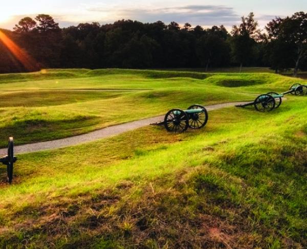
Today (2003) a large portion of the Appomattox Station battlefield is under the town of Appomattox. Still, traces of the original wagon road system exists that ran from the Richmond-Lynchburg Stage Road to the station as does that portion where the final stand of Walker’s artillery against the Federal cavalry took place. For the time being an interpretive opportunity exists to at least preserve this final segment of the battlefield before it too becomes buried under some sort of development.
The Battle of Appomattox Station was certainly not a major turning point in the final campaign from Petersburg but did place another nail in the coffin in forcing Lee to surrender his army at nearby Appomattox Court House the following afternoon. A member of the 1st New York Cavalry, Samuel Stevens, wrote, “ We overtook them [Lee’s vanguard] on the eve of April 8th, at Appomattox [Station]. We made a charge that cut off their retreat. We had a fierce battle that lasted into the night. In this battle my horse was shot from under me. Three bullets pierced him – two in his head and one in his flank. The only way we could tell where to fire was by the flashes of the rebel [artillery] pieces. The firing ceased about nine o’clock.” The engagement’s significance can best be described in a post-war account of the war. “In the general report of that struggle [Appomattox Station], as given by different historians, mention has only been made of it in general terms, but for fierceness, and a reckless display of courage, perhaps there cannot be found among the annals of the entire war a parallel.” To understand the final events that caused Lee to surrender his once powerful Army of Northern Virginia the next day, Appomattox Station is a key element for that chronology.
ARTIFACTS FOUND AT JAMERSON TRUCKING COMPANY
& BEHIND CARVER PRICE SCHOOL:
Projectiles:
.52 Sharps Carbine bullets – 6
.45 Pistol bullets – 4
.52 Spencer bullets – 3
.58 3-ring bullets – 13
.58 CS mfg. Salvaged Lead bullets – 2
.54 Richmond Lab. CS Sharps – 5
Other Items:
- Shell fragments
- Friction Primers – 13
- Canister balls, various sizes – 225
- Complete ground burst Schenkl shell w/case shot and pewter percussion fuse
- Handmade lead eagle button
- “A” tinback button
- “I” tinback button
Upon returning to the site after determining its provenance, April 13, 1990:
- Canister balls – 96
- Friction primers, unfired w/wire – 17
- Friction primers, fired – 20
- Iron case shot – 40
- Shell fragment – CS Reed
- Shell fragment – 12 Pdr. Ball
- Shell fragment – 3” shell
- Fired .56 Spencer bullet
- Fired .52 Sharps bullet
- Fired .45 pistol
- .58 CS nose cast bullet
Related Battles
121
1,000