New Insights into Cedar Mountain Photography

Soldiers walking across Cedar Mountain
The circle in the photo on the left indicates the damaged fence line and disturbed ground from recent burials that appear in the photo on the right. Library of Congress

In August 1862, Mathew Brady photographer Timothy O'Sullivan traveled to Northern Virginia to capture photographs following the aftermath of the recent Battle of Cedar Mountain. Learn more about the battle and some new discoveries about these battlefield photographs.

Sketch of the Battle of Cedar Mountain by Edwin Forbes
The Battle of Cedar Mountain, also referred to as Slaughter’s Mountain, by Edwin Forbes, 1862.

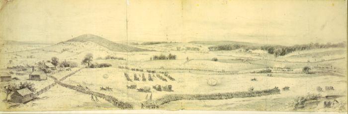
The Battle of Cedar Mountain, which took place on August 9, 1862, was part of the Northern Virginia Campaign. Union Maj. Gen. John Pope was advancing through Virginia in hopes of capturing the railroad at nearby Gordonsville, when his troops ran into Lt. Gen. Thomas “Stonewall” Jackson’s 14,000 Confederates. Although the Federal troops gained an initial upper hand, the Confederates eventually won the battle with help from A.P. Hill’s division.

Confederate troops set up their artillery along the intersection of the Orange-Culpeper Road and the Crittenden Lane, a spot that became known as “the Gate.” Although Confederate guns fired from this position for nearly two hours, Union cannon aimed deadly return fire and slowed the advance of Confederate infantry through this area. The Civil War Trust preserved 152 acres here in 1998.

Then and now photos of "The Gate" at Cedar Mountain
These side-by-side photos show a portion of the Crittenden Lane, “then and now.” The circled wood line in the August 1862 photo, left, still maintains the same contour today, as seen in the modern photo at right. The American Battlefield Trust land is on the right of the road and in the distant wood line.

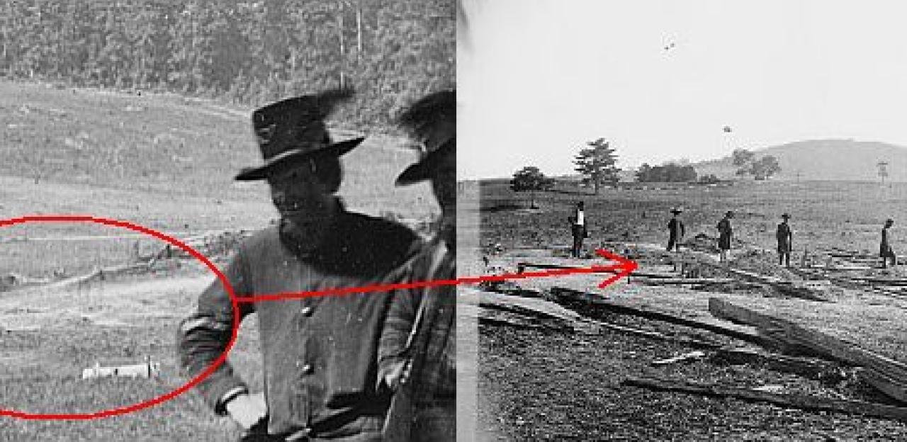
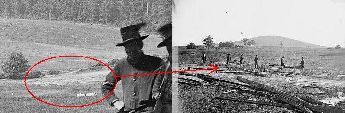
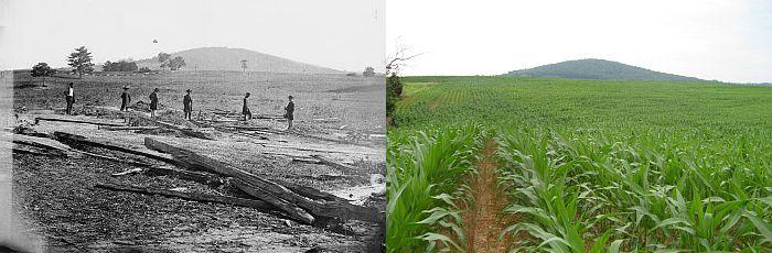
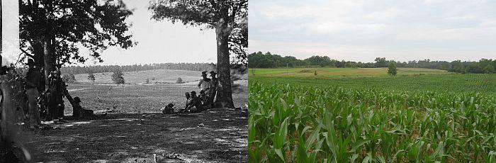
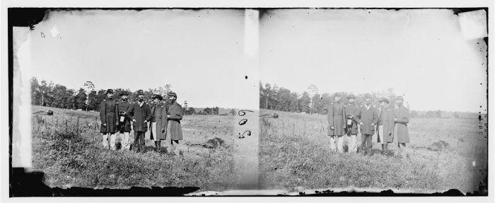
This fascinating pair of August 1862 photos by Timothy O’Sullivan, shows a fresh battlefield as the soldiers saw it. They also show the same portion of the Cedar Mountain battlefield preserved by the American Battlefield Trust, from opposite directions.

Photograph of the Cedar Mountain landscape
In 2007, Garry Adelman discovered that the trees circled in the left photo are the two trees in the foreground of the photo on the right and also that the area shown in the small circle in the photo on the right is the spot where the men are standing by fresh Union graves in the photo on the left. Library of Congress
Photographs of the Cedar Mountain Battlefield from different angles
The arrows extending from the detail of the photo on the left indicate the specific parts of trees and hedge corresponding with the photo on the right. Library of Congress
Soldiers walking across Cedar Mountain
The circle in the photo on the left indicates the damaged fence line and disturbed ground from recent burials that appear in the photo on the right. Library of Congress

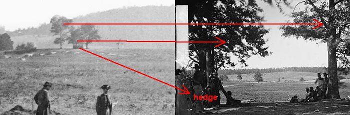
When land is preserved and photo resources exist, we can stand today at the very spot from where Civil War photos were taken. Get on out to our Cedar Mountain walking trail to line up this photo.

Then and now photos of the Cedar Mountain battlefield
Cedar Mountain still looms over the battlefield in this “then and now” shot. Library of Congress and Garry Adelman
Then and now photos of the fields at Cedar Mountain
Beyond the field, you can still see the same small hill covered by a line of trees today as it appeared in the August 1862 photo. Library of Congress and Garry Adelman

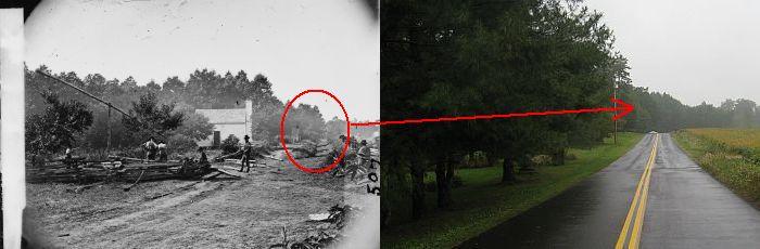
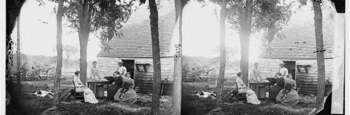
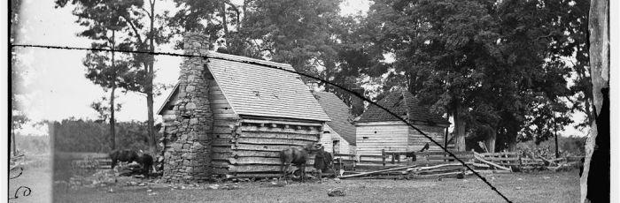
A bit of mystery surrounds the spot where Confederate Brig. Gen. Charles S. Winder died after being mortally wounded at the battle of Cedar Mountain. According to original captions on each of these photos – taken by the same photographer – these  structures, just a few yards apart, is supposedly the location where Gen. Winder spent his dying moments.

An account from the memoir of Confederate soldier McHenry Howard notes that after being hit, Winder was carried to a local schoolhouse a little less than a mile away from the fighting. Which of these photos depicts the actual schoolhouse, or whether either is a schoolhouse at all, remains a mystery.

Photograph of a family sitting in front of a home near Cedar Mountain
This stereoscopic photo shows a family sitting in front of one the structures that is claimed to be the spot where Gen. Winder died. Most Civil War photographs were recorded with twin-lens stereoscopic cameras to produce 3-D images. Library of Congress
Photograph of a log cabin at Cedar Mountain
This photo, also taken by O’Sullivan in August 1862, also shows one of the structures claimed to be the spot where Gen. Winder died. The damage from cannon is noticeable in this log cabin. Library of Congress

The 10th Maine Infantry Regiment served in Maj. Gen. Nathaniel Banks division, and was directly involved in the fighting at Cedar Mountain against “Stonewall” Jackson’s troops. The 10th Maine suffered heavy casualties, including 22 dead, in fierce fighting – much of it hand-to-hand, as General Pope later wrote in his official report.

Photograph of of five men from the 10th Maine Regiment standing amidst horse carcasses after the Battle of Cedar Mountain
Photographer Timothy O’Sullivan captured a stereoscopic picture of five men from the 10th Maine Regiment standing amidst horse carcasses after the battle. Pictured are Lt. Littlefield, Lt. Whitney, Lt. Col. Fillebrown, Capt. Knowlton, 1st Sgt. Jordan. These are the same men standing by the Union graves in the photo above. In all, O’Sullivan’s coverage of the field was a remarkable documentary accomplishment. He secured the first photos of dead horses on an American battlefield and only the second known series of fresh battlefield graves. Library of Congress
CalltoArms
Help Save Brandy Station battlefield before it’s too late

This will be the only chance we will ever have to protect these 97 acres at Brandy Station, and the other 7 acres near Cedar Mountain, and we urgently...

Related Battles

Culpeper County, VA | August 9, 1862
Result: Confederate Victory
Estimated Casualties
3,691
Union
2,353
Confed.
1,338